
Apple Valley Neighbor Sources
Official records answer different block questions. In Apple Valley, Minnesota, Dakota County’s property search links a parcel to tax and building information. The parcel map shows the land beside it. RecordEASE can extend a property question into recorded documents, while MNVotes is designed for an individual registration check rather than a street browse. Apple Valley civic programs help residents meet and organize, but they do not publish a household roll. Read the source’s purpose before drawing a conclusion about people around an address.
| Source | What It Shows About a Block | Access |
|---|---|---|
| Dakota Property Information | Site address, parcel identity, property, tax, and building panels | Free address or PID search |
| Dakota County parcel map | Target polygon, shared edges, TAXPIN, and site-address context | Free map and GIS terminal access |
| RecordEASE | Recorded parties, legal descriptions, and document-chain context | Account, subscription, and copy routes |
| MNVotes and voter-list law | Individual registration status or tightly controlled list access | Official lookup or qualifying statutory request |
| Apple Valley civic programs | Neighborhood Watch and Night to Unite participation information | City program information |
A property card can name an owner and an owner mailing address, while the situs is the parcel’s physical location. Those are separate fields. A map edge also establishes only land contiguity. Neither field proves that an owner, a former owner, a voter, or a program participant lives at that location.
| Official record route | Unspecified commercial neighbor tools |
|---|---|
| Shows the record keeper, field purpose, and access limit. | May combine fragments without showing when or why each field was collected. |
| Lets a reader check a parcel, document, or civic source at its custodian. | Cannot substitute for a current county record or prove occupancy. |
| Supports narrow questions about land, documents, registration, or programs. | Should not be used to assemble a person-by-person block profile. |
Map Apple Valley Neighbors
Start with the target parcel, then use the county’s tax-parcel polygons to understand the immediate block. The ArcGIS property layer has TAXPIN, full name, building number, site address, and city, state, and ZIP fields. The polygon layer supplies TAXPIN and SITEADDRESS with the parcel boundary. That pairing makes a careful sequence possible: identify the target polygon, inspect the shared boundary, then open each adjoining polygon by its parcel identifier. It is a land map, not a people map.
- Enter a full or partial house number and street, or a 12-character PID with or without dashes, in Dakota Property Information.
- Confirm the returned site address and PID, then identify the target on the tax-parcel layer.
- Click the polygons that physically share the target boundary and record each TAXPIN or site address before opening its property card.
- Use the legal description and current property information for a document question, not as a shortcut to an occupancy claim.
For a named street rather than the immediate block, use the Apple Valley street directory. Adjacent polygons can be helpful for orientation, but they show contiguous land only. They do not establish shared ownership, a shared household, or a personal relationship.
Note: Shared parcel edges establish map adjacency only, so they do not prove a relationship, shared ownership, or shared occupants.
Apple Valley Neighbor Property Cards
The free county search accepts a full or partial address, including a house number and street, or a 12-character Parcel ID. After a result is selected, the Property Information, Tax Information, and Building Information panels divide the record by purpose. Property Information can show the owner, owner address, municipality, tax description, school district, and watershed. Tax information can show current and prior taxes, special assessments, and homestead information. Building fields can include year built, bedroom and bathroom counts, and square footage.
| Field or control | Type | Requirement | County format or result |
|---|---|---|---|
| Parcel ID / PID | Text | One search route | Enter the 12-character identifier with or without dashes |
| Address / street | Text | One search route | Use a full or partial house number and street |
| Search | Button | Required to run a query | Runs the address or PID search |
| Legend | Map control | Optional | Opens the symbol explanation |
| Layers | Map control | Optional | Toggles available map overlays |
| Basemap | Map control | Optional | Changes the map background |
| Property, Tax, and Building Information | Tabs or panels | After a parcel result | Separates the three record views |
| Property Details | Link or button | After a parcel result | Creates a printable PDF and may link to related property material |
See the city’s Neighborhood Watch guidance in the official Apple Valley resource captured below. It is a civic contact route, not a list of nearby households.
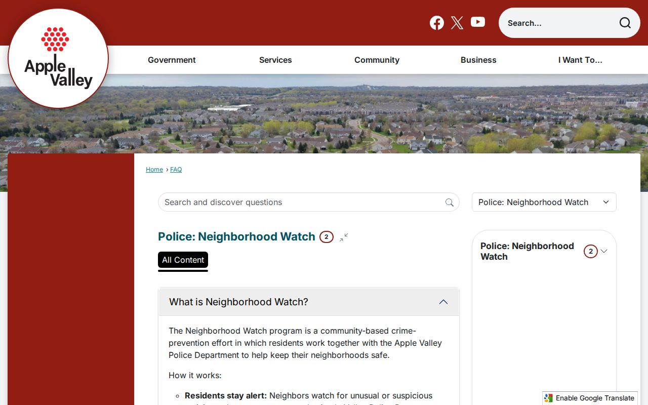
The program material is useful when a block question is about participation and communication. Property-card fields remain the county source for parcel and tax facts.
Apple Valley Neighbor Deed Trail
Use the parcel’s legal description or PID to move from the assessor card to Dakota County RecordEASE when the question concerns a recorded transfer. RecordEASE separates Abstract and Torrens records. Its Abstract Computer Index reaches back to July 8, 1993, and web access requires an account or subscription. The county’s fee schedule, recorder channels, public terminals, and copy requests provide other routes when a document or older record is needed.
- Begin with the current owner, PID, and legal description from the property record.
- Capture the document number, recording date, instrument type, parties, and legal-description reference.
- Use the prior grantor and the legal description to continue backward when the document supports that step.
A grantor or grantee is a party to a recorded instrument, not a statement that the person currently lives nearby. The legal description is the durable bridge between a modern parcel and the recorded chain, especially where parcels were split or combined.
Apple Valley Civic Neighbor Programs
Apple Valley offers official ways to participate in block life without treating civic activity as a resident directory. The city’s Neighborhood Watch information covers watch, block-party, report, and fingerprinting FAQs. Night to Unite is another city route for neighborhood block-party and civic safety information. Neither program is an official roster of residents, an association registry, or evidence that a particular person is at a particular address.
Neighborhood Watch
Apple Valley Neighborhood Watch FAQs provide city guidance for watch and block-party questions.
Night to Unite
Night to Unite is the city’s civic route for neighborhood event information.
No verified official citywide Apple Valley neighborhood-association directory was located. That gap matters. An unverified association name or informal contact list should not be presented as a public record or a complete account of a block.
Note: Civic-program participation can support community contact, but it does not establish residency, ownership, membership, or a public directory listing.
Apple Valley Neighbor Voter Boundaries
MNVotes is an individual registration lookup. It requires first name, last name, date of birth, and address information through ZIP or county, city or township, house number, and street. It updates nightly, although an official change can take time to process. The result confirms registration status and official next steps. It is not a public tool for browsing a block.
Minn. Stat. §201.091 permits a qualifying Minnesota-registered voter to request a public-list copy with identification and a signed statement for a lawful election, political, or law-enforcement purpose. The list has statutory limits: it cannot be placed online as a searchable file or republished, sold, loaned, or accessed contrary to the law. It also excludes date of birth, Social Security numbers, ID numbers, and private party-choice data. Safe at Home and safety withholding must be respected.
Apple Valley lists 16 precinct locations, but precinct boundaries and polling locations can change by election. A precinct, a parcel, and a postal label are different geographic tools. No public Apple Valley block-by-block voter browse interface was verified.
Apple Valley Neighbor Geography
Block research can fail when the locality label is treated as a boundary. ZIP 55124 has a preferred USPS city label of Saint Paul, while Apple Valley is acceptable and Dakota County prefers Apple Valley for its address points. A ZIP, city limit, precinct, school district, and parcel map layer may not line up. Confirm the municipality and site address in county GIS instead of relying on the mailing city alone.
Older property questions also need the right historical name. The area was Lebanon Township before the incorporation vote that created the Village of Apple Valley context in 1969, and statutory-city records begin in 1974. That history is a practical search aid when an older parcel or deed record does not appear under today’s city label.
View the Lebanon Cemetery history preserved in the official Apple Valley image below. Its early record history shows why people and place records can predate the modern city name.
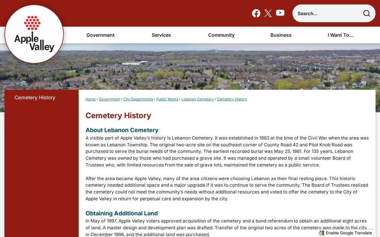
The cemetery has an early recorded burial date and an 1863 establishment history, but no verified public online name-search database. Its city record route does not replace the parcel map for a present-day block.
Apple Valley Neighbor Record Requests
When an existing county file is not online, make a narrow request under the Minnesota Government Data Practices Act, Chapter 13. Name the record type, date range, address or PID, and whether inspection, copies, or both are wanted. Government data is presumed public unless another law classifies it differently. Inspection is free, while copies can carry a charge. A request can seek an existing record or export, but it cannot require Apple Valley or Dakota County to create a household list.
Dakota County GIS
The public terminal is on the third floor of the Western Service Center, 14955 Galaxie Avenue. Public map access is free. GIS can be reached at 952-891-7081 or gis@co.dakota.mn.us.
County data request
Dakota County’s Chapter 13 request guide directs general county requests to the responsible custodian and explains inspection and copy choices.
Property Records also lists records@co.dakota.mn.us and 651-438-4576 for property questions. Ask the custodian to identify redactions and the legal basis for any withheld part of a record.
Note: A focused request supports review of an existing public file, not compilation of sensitive information from unrelated county systems.
Apple Valley Neighbor Privacy Limits
Public access does not erase Minnesota privacy boundaries. Property data identifies a tax or ownership relationship, not every person connected with the parcel. MNVotes does not create a public block directory, and voter-list rules limit who can obtain copies and how they may be used. Safe at Home participants have assigned addresses for protected mail handling. Do not infer, discover, or republish a protected real address from a different record.
Lawful use. Use a parcel map or civic source for a narrow, lawful purpose and stop when the source limit is reached. Repeated unwanted contact, monitoring, threats, or conduct causing fear can implicate Minnesota’s harassment and stalking laws, including Minn. Stat. §609.749 and Minn. Stat. §609.748.
A useful block record has a source, a date, and a purpose. Keep it that way. Do not turn parcel boundaries, mailing fields, civic participation, or a lawful voter-list request into a dossier about another person.